Research progress and prospects of indoor navigation and positioning technology
Abstract: In order to further study the methods and techniques of indoor navigation and positioning, on the basis of analyzing indoor positioning methods and classification, the research progress and application status of indoor navigation and positioning technology are summarized, and the development prospects and difficulties of indoor positioning technology are discussed. Finally, The research trends of indoor positioning technology and methods are given.
Keywords: indoor navigation; indoor positioning technology; application progress
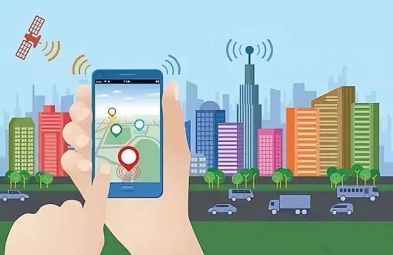
Indoor navigation and positioning system refers to the use of different technologies in various indoor spaces to achieve indoor navigation and positioning and tracking of people and objects. With the development of the Internet of Things technology, the positioning needs of personnel and objects in economic activities, personal activities, military and other application fields are increasing. Outdoors, there is a global navigation satellite system (GNSS), which is a universal and mature solution that allows people to navigate and locate outdoors; but in today's increasingly large indoor spaces, in various factory buildings, The continuous construction of large shopping malls, office buildings and subway stations is essential for the safety and monitoring of people and objects based on indoor navigation and positioning. The demand for location services in indoor environments has become increasingly prominent. A lot of exploration and research. At present, indoor navigation and positioning systems are mostly based on proximity detection, triangle, multilateral positioning, and fingerprint positioning methods, or a combination positioning method for improving accuracy. However, due to the influence of multipath effects, the indoor environment is versatile and complex, and there is no universal solution; therefore, how to improve accuracy, real-time, security, increase scalability, and reduce costs is still a research hotspot, making people In the life or work environment, you can get location information anytime, anywhere, and enjoy the convenience of location-based services.
Based on the review of the research progress and application status of indoor navigation and positioning technology at home and abroad, this paper analyzes and discusses the development trend and difficulty of indoor positioning technology, and gives the research trend of indoor positioning method and technology based on their own thinking.
1 Method and classification
1.1 Method
The principle of most indoor positioning techniques is to determine the relative distance between the receiver and the known signal point based on the reception of the signal by the receiving device. In addition, the use of feature alignment and occlusion of the signal by the locating object is also a common technical method. The comparison and analysis of the main indoor positioning methods are shown in the following table.

1.2 Classification
In [7], the paper proposed an indoor positioning classification system in 2001, which classified according to the location type of positioning, the coverage of the positioning, the accuracy, the signal used, and the absolute/relative positioning and active/passive positioning, in order to let the location service developer Learn more about their performance in a more comprehensive way. Literature [8] proposed three classification methods: location-based sensing technology, signal-based measurement technology, and sensor-based classification. Literature [9] is divided into geometric based, fingerprint positioning method, cost minimization and Bayesian technology method according to the positioning algorithm. According to the positioning method, the literature [10] is divided into three categories: satellite, base station and perceptual positioning. Literature [11] proposes to classify according to the positioning principle and transmission signal, and Professor Chen Ruizhi of Wuhan University also classifies according to different positioning sources. These classification studies have facilitated the development of indoor positioning technology.
2 Research progress
2.1 Sensor-based indoor positioning technology
1) Infrared positioning
The infrared positioning system generally consists of two parts: a mobile station equipped with an infrared transmitter and a base station. The Olivetti Research Laboratory is the first to be developed by Cambridge AT 2) Ultrasonic positioning
The ranging methods used in ultrasonic technology are mostly reflective ranging methods, and the distance to be measured is obtained by calculating the time difference. Of course, the distance from the ultrasonic wave to the measured object can also be directly measured by the one-way ranging method. These two methods generally use methods such as multilateral positioning to determine the position of the measured object.
The Active Bat system developed in 1997 is based on ultrasonic technology. The Active Badge system based on infrared positioning has higher positioning accuracy and positioning accuracy of 3 cm. In 2000, the MIT Cricket indoor positioning system based on the Active Bat system did not need to arrange fixed sensors. Instead, it used ultrasonic transmission time and RF control signals to achieve three-dimensional positioning. In the hardware layout, the ultrasonic positioning technology is relatively high, so the cost is relatively high, but its structure is simple, the positioning accuracy is high, and the average can reach the centimeter level.
3) Inertial navigation positioning
Inertial navigation positioning is the use of inertial sensors such as accelerometers, gyroscopes or magnetometers to collect some parameter information of an object to determine position information. Generally, the dead reckoning algorithm has been widely used in some military security fields, and the sensor quality and the placement position of the sensor affect its positioning accuracy.
In [19], a set of positioning systems suitable for military police is constructed based on inertial devices, and the idea of joint positioning between users is constructively proposed. However, the influence of cumulative error caused by inertial navigation and positioning technology cannot be ignored. Combine with other positioning systems to achieve high precision positioning. For example, in the early stage, a wireless local area networks (WLAN) positioning system was used to provide initialization and correction methods, or in seamless positioning research and application, inertial navigation positioning systems are often combined with GNSS systems. There are also mature micro electro mechanical systems (MEMS), and low-cost motion sensors such as accelerometers, gyroscopes, inclinometers, barometers and magnetometers based on smartphone platforms can be used for pedestrian trajectory estimation. Pedestrian dead reckon, PDR). At present, the integration of PDR with geomagnetism or with wireless fidelity (WiFi) is gaining more and more attention.
4) Visual positioning
Japan's research in the field of vision is the world's leading. Relatively speaking, China started relatively late. Computer vision is often used for robot positioning. The robot is equipped with a camera to capture the surrounding environment, processing and analyzing relevant data according to the captured image and positioning the robot. There are many ways to visually locate: the most popular positioning method for monocular cameras based on mobile devices is image matching; and the positioning method based on camera intersection is mainly based on the principle of density matching and structure from motion (SFM). One step is based on the establishment of the image feature database of the crowdsourced image, and the feature target of the salient image is found and solved. The second step is based on a single photo camera intersection positioning system, which is relatively complicated. The advantages of computer vision positioning technology are wide signal detection range, complete information acquisition, etc., but relatively higher requirements on the processor [23].
The EasyLiving system is a computer vision-based positioning system that uses a high-performance camera with high accuracy. However, when the indoor environment is complex, it is difficult to maintain high precision. A visual sensor can be introduced by the principle of mobile robot synchronous positioning and mapping (SLAM). Literature [25] implements the SLAM algorithm by using a low-resolution camera based on the reference image, so that the accuracy can reach the sub-meter level. The EV-Loc indoor positioning system proposed in 2012 is a positioning system that uses visual signals as an auxiliary positioning to improve accuracy. Based on the principle of visual positioning, Google's visual positioning service (VPS) technology has a theoretical accuracy of up to centimeter level.
2.2 Indoor positioning technology based on RF signals
1) WiFi positioning
People's lives have been surrounded by wireless LANs. WiFi positioning has become a wide-ranging technology because of its low cost. Baidu, Gaode, WiFiSLAM, Sensewhere, and Tuju Intelligent have joined in. The advantage of its positioning is that no additional equipment is required, the deployment cost is low, and the power consumption is low. The user can use the mobile phone to turn on the WiFi and the cellular network anytime and anywhere, and the positioning cost is low and the applicability is strong, so the scale is realized at the earliest.
WiFi indoor positioning technology generally has two types: one is based on the received signal strength indication (RSSI) distance intersection method, because the relationship between signal attenuation and distance changes under different environmental conditions, the result The other is based on the RSSI position fingerprint method. The signal matching is the main part of the research. The positioning accuracy lies in the calibration point density. It does not need to deploy too many hardware facilities. It is currently used more WiFi. Positioning method. The RADAR indoor positioning system developed by Microsoft Corporation can achieve an accuracy of 2 to 5 m in an open indoor environment. The method of improving the accuracy of the HORUS system is to use the probability model of wireless signal data as the positioning feature parameter, but in the early stage, a large amount of fingerprint acquisition is needed as the basis to determine the accurate fingerprint probability distribution. Although the accuracy of the Mole and EPE systems can meet the requirements, the algorithm is extremely complicated, so the speed of positioning cannot be met. In addition, the US WiFi SLAM and China's "wing peripheral" and other systems have high requirements for the operation and maintenance of the database, and are generally used in the layout of important locations. With the continuous improvement of the positioning scheme, in 2010, Microsoft Research Institute proposed an indoor positioning system based on EZ algorithm with the support of WiFi technology. This system does not require a lot of preliminary research, only on the more powerful central processor. Do a lot of complicated calculations.
2) Bluetooth and ZigBee positioning
Both Bluetooth positioning and ZigBee positioning technology are based on short-range low-power communication protocols. The methods implemented can be centroid positioning, fingerprint positioning and proximity detection; both have the advantages of low power consumption, close range, and wide application. However, at the same time, the stability is poor and the environment is greatly disturbed.
Bluetooth positioning technology is based on the measurement signal strength. Apple has developed an accurate micro-positioning technology iBeacon based on low power consumption. China's "seeking deer" positioning system also uses this mode for positioning. The Bluetooth 5.0 protocol released in 2016 will provide technical support for high-precision indoor positioning. At present, the fingerprint positioning method which is mostly used by Bluetooth technology is mostly based on this method. ZigBee indoor positioning is realized by mutual communication between each blind node, and the method based on it is proximity detection. At present, the ZigBee positioning technology is improved by methods such as fuzzy clustering, and the positioning accuracy can reach the meter level.
3) Cellular network positioning
Cellular network positioning is mainly used for positioning of smart phones. It relies on detecting characteristic parameters of propagation signals to achieve positioning. Commonly used positioning methods include proximity detection method and based on observed time difference of arrival (OTDOA). The advantage of this positioning technology is that it can form a universal indoor positioning scheme, but the disadvantage is that due to the influence of system design and poor time synchronization accuracy, the accuracy is generally low, about 50-300m. Ericsson uses the OTDOA method to achieve an accuracy of 50 m. Some adopt multi-antenna MIMO+TDOA technology, and the positioning accuracy can reach 5~10m. Future developments such as technologies based on 5G communication networks are expected to achieve higher accuracy.
4) Radio frequency identification and positioning
Radio frequency identification (RFID) is a technology that uses radio frequency signals to automatically identify objects and obtain relevant information. RFID technology was used by the United Kingdom to identify aircraft as part of radar improvements during World War II. Combined with smart sensor technology, RFID technology has become the core technology of the Internet of Things. The utility model has the advantages of long radiation distance, ability to bypass obstacle transmission, low cost of equipment, high portability, easy maintenance, high positioning accuracy, etc., but the working distance is short and the received signal strength may be unstable.
A representative RFID system positioning system is Microsoft's RADAR system, which is an indoor positioning solution based on RSSI measurement, but its low scalability is highly dependent on the environment. The University of Washington's SpotON system [37] uses iterative calculations using an aggregation algorithm, but it is extremely computationally intensive. Based on the dynamic identification RFID calibration (LANDMARC) proposed by Michigan State University, the core of the algorithm is to achieve localization by the proximity method. The researchers then based on this algorithm. A lot of improvements have been made. At present, researchers' research on algorithms has continued, which has made RFID technology more mature.
5) Ultra-wideband positioning
Ultra-wideband (UWB) positioning was first applied in the US Air Force. By 2002, the US FCC had adopted the proposal that UWB positioning could be applied to civilian use. The utility model has the advantages of simple structure, low realization cost, low power consumption of the transmission signal, strong penetrating power of the signal, high safety, high signal rate, large communication channel capacity, and the positioning accuracy can reach the centimeter level. Compared with other wireless communication technologies, UWB is easy to integrate positioning and communication, so it is more suitable for complicated indoor space.
In terms of application development, the chip Driver2 and Aether5 have the advantages of small size, strong penetrating power and low power consumption. Ubisense's UWB real-time positioning system products work in the frequency range of 5.8 ~ 7.2GHz, using the method of multilateral positioning and triangulation, positioning accuracy of up to 15cm. DecaWave developed the Scen-Sor series of wireless indoor positioning chips, in which the smallest positioning error in the product is less than 10cm, but due to its high cost, it has not been widely used. In order to better optimize indoor positioning services, the combination of ultra-wideband technology and RFID technology can be used for accurate indoor positioning.
2.3 Fusion positioning technology
The fusion of position information by different sensors is called fusion positioning. Integrating multiple positioning technologies for indoor positioning is currently a hot topic. Professor Chen Ruizhi of Wuhan University divided the fusion positioning method into tight coupling and loose coupling. Professor Deng Zhongliang of Beijing University of Posts and Telecommunications proposed indoor integration of WiFi, Bluetooth, inertia, vision and other means to create a multi-compact positioning model, combined with outdoor GNSS. Realize the “meter” level of seamless positioning inside and outside the large buildings. Combining the advantages of multiple technologies to achieve higher accuracy and thus improving the robustness of positioning is a major advantage of fusion positioning.
There are a variety of existing indoor positioning fusion research programs. Literature [39] proposes to construct a hybrid positioning system based on WiFi, magnetic field strength and cellular signals. In [40], WiFi measurements combined with PDR achieve higher accuracy. Reference [41] uses Bluetooth RSSI measurement and accelerometers and barometers on smartphones to perform indoor three-dimensional positioning. Reference [42] implements a combination of geomagnetic field positioning and inertial sensors, providing a reliable positioning method that does not require infrastructure. Literature [43] proposes to use only the inertial measurement unit (IMU), barometer, ultrasonic, and camera carried by itself, and adopts the method of developing particle filtering without the need of infrastructure for fusion. The accuracy of the experimental results can reach 3m. These can be said that the integrated positioning system is superior to the single positioning system in terms of stability and precision.
2.4 Other positioning technologies
The geomagnetic positioning technology determines that the indoor position is characterized by different magnetic field strengths at different points in the indoor environment, similar to the WiFi fingerprint method. The IndoorAtlas of the University of Oulu in Finland is a representative system using geomagnetic positioning technology with an accuracy of 0.1 to 2 m. NFC technology realizes positioning by approaching distance. By arranging the sensing tag and knowing the position of the sensing tag to determine the position of the mobile device, the advantage is that it is simple and fast, and the disadvantage is that the state of the pedestrian between the tags cannot be sensed. Achieving wide-area coverage must be integrated with motion sensors. The main technologies used in LED visible light communication are camera technology, image capture technology, mobile terminals and so on. Terminal-based LED optical positioning technology is a research hotspot in this field, mainly including optical network technology and multi-mode fusion technology. The Bytelight positioning system is based on the modulation of specific light signals to the light source to achieve positioning, up to the level of positioning accuracy, Ubeacon system is also developed using LED positioning. Multi-user co-location means that users can measure each other by receiving signal strength to obtain mutual distance, which can make the information more fully utilized and better in stability.


 English
 Español
 Русский
 Deutsch
 Français
 Português